

The trail initially passes through the forest and then continues along the Kyparissia River, offering panoramic views of the Germasogeia dam and the city of Limassol.
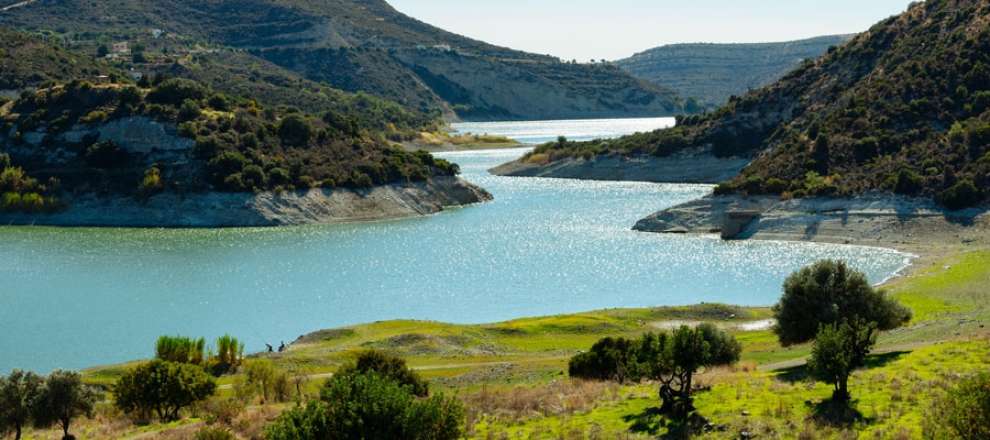
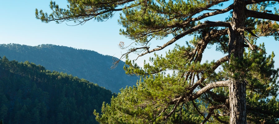
The trail runs through the forest and surrounded by hills with Cypress trees (Cupressus sempervirens var. horizontalis), and at some point connects to the circular trail of Germasogeia dam. The Kyparissia Forest is a Natura 2000 protected site.
Flora
While hiking you can explore the endemic plants: Entire – Leaved Horehound (Acanthoprasium integrifolium), Kakomallis Alison (Alyssum chondrogynum), Thyme (Thymus integer), Shrubby knapweed (Ptilostemon chamaepeuce subsp. cyprius), Cyprus Yellow Sun Rose (Helianthemum obtusifolium).
Fauna
The main species of fauna found in the area are:
Mammals: Fox, hare, hedgehog.
Birds: Bonelli’s eagle, Wood pigeon, partridge, Cyprus warbler (endemic), Cyprus wheatear (endemic).
Reptiles: Cyprus viper, Cyprus lizard, Black whip snake.
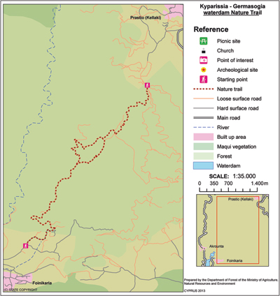
| GPS coordinates of the starting point: | Lat: 34.794998 Lon: 33.136578 |
| GPS coordinates of the ending point: | Lat: 34.759798 Lon: 33.104231 |
| Altitude of the starting point: | 562m |
| Altitude of the highest peak: | 692m |
| Altitude of the end peak: | 140m |
| Starting point: | Around 3km from the main Parekklisia – Kellaki road. |
| Length: | (a) 3.7km (circular), (b) 11km (ends at Germasogeia Dam) |
| Estimated duration: | (a) 1.5 hour, (b) 3 – 3.5 hours |
| Difficulty rate: | (a) 2 (there is a steep downhill at the start), (b) 3 (there is a steep downhill at the start) |
Natural trails of Cyprus. Part III. Xyliatos – Adelfoi Forest


